Ride-Sharing Proximity Engine with Geohashing
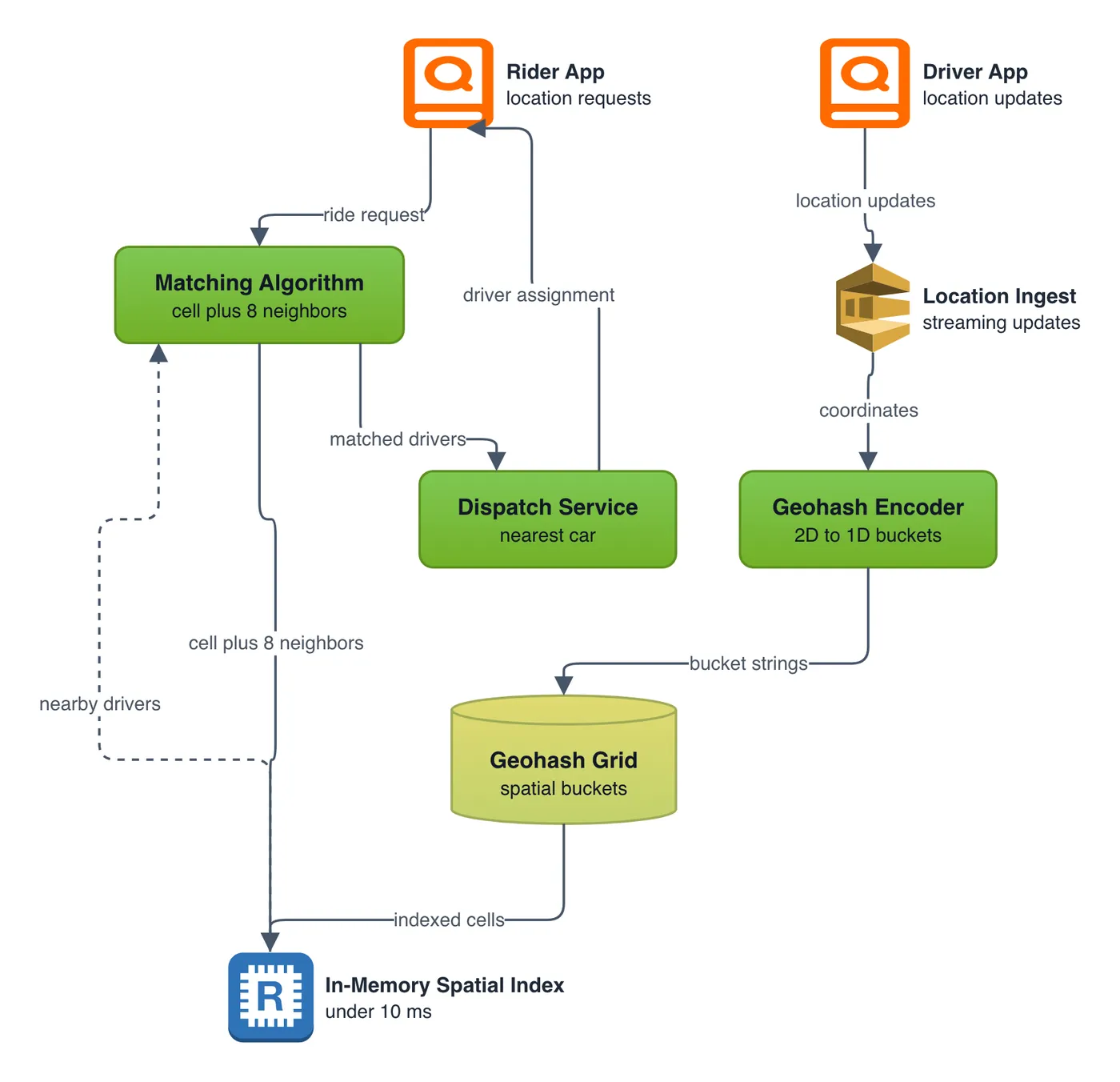
System Design diagram · made in Skemio
What it shows
- Geohashing converts 2D coordinates into 1D alphanumeric bucket strings.
- Matching algorithms query the rider's cell plus 8 adjacent neighbor boxes.
- In-memory spatial indexes keep location updates under 10 milliseconds.
The takeaway
Spatial indexing converts quadratic distance scans into constant-time key lookups.
- #SystemDesign
- #Geospatial
- #Algorithms
- #BackendDev
- #SoftwareArchitecture
- #DataStructures